
Intake & Triage
Where today's problems are, on the page you land on.
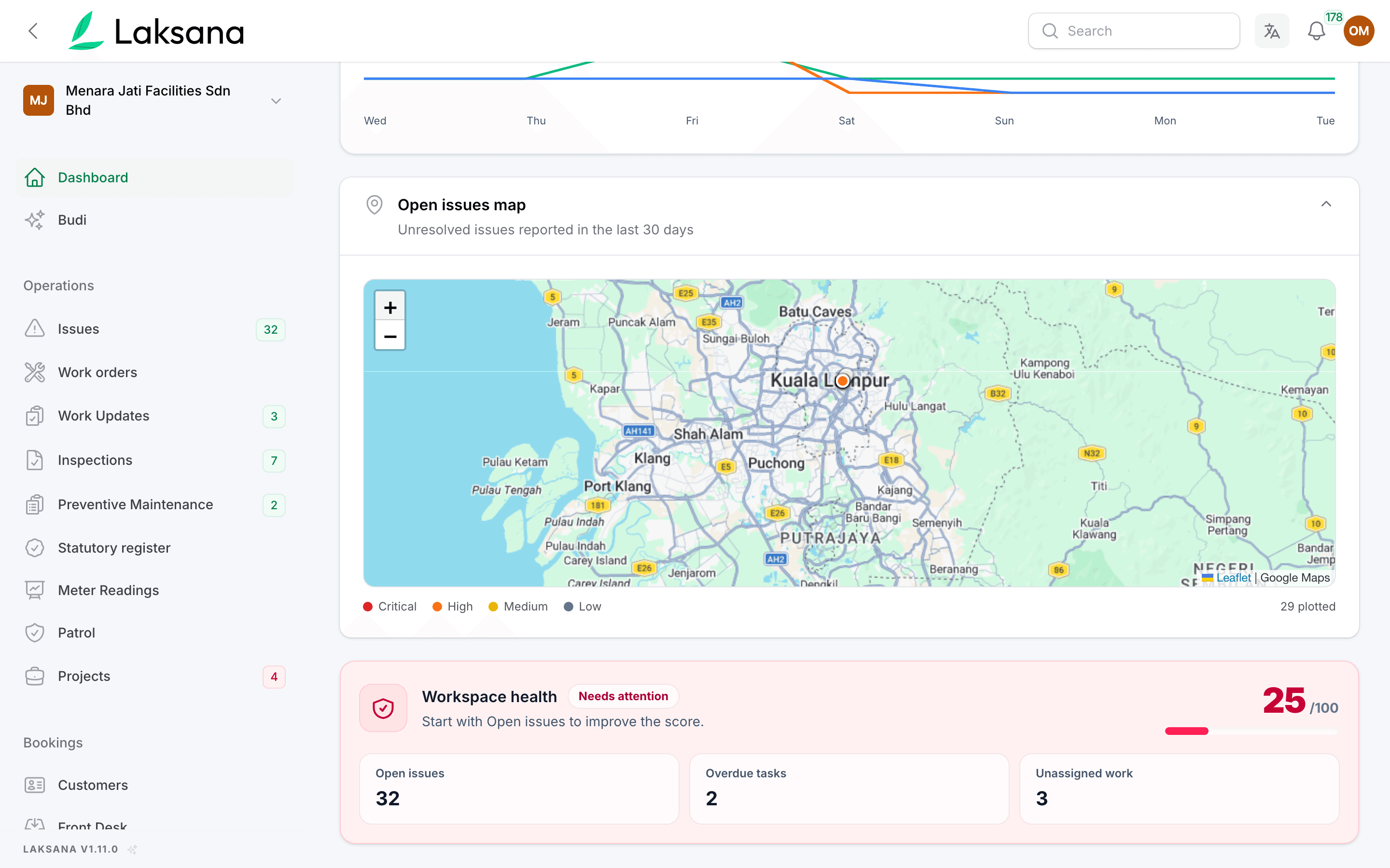
Every open issue reported in the last 30 days with a location is pinned on the dashboard, coloured by severity. The Map report goes further across the whole estate and any date range, and a shared record shows a pin where the photo was taken.
- 3.1390° N, 101.6869° E
- Critical · High · Medium · Low
- 32 plotted · last 30 days
- Reports → Map
The problem
A fault arrives as words. Someone still has to work out where it is.
Chiller bocor kat plant room L2
Location by description. "Near the lift, level 2" has to be decoded before anyone can be sent, and the wrong guess costs a trip.
Which block got the most complaints this week?
Patterns hide in lists. A run of leaks on one wharf or one block stays invisible in a flat ticket list until somebody counts by hand.
Boss, alamat exact kat mana?
Directions by phone call. The contractor rings to ask where to go, because the work order has a description but no pin.
How It Works
From a photo's coordinates to a pin.
Location comes from the photo or the reporter's phone at the moment of reporting — nothing is typed in.
1
Located at report time
Coordinates travel with it. A fault reported from WhatsApp, Telegram, a QR scan or the helpdesk carries the coordinates of its first photo or the reporter's device.
2
Pinned on the dashboard
Pins on load. Open issues from the last 30 days appear as pins the moment the dashboard loads, coloured Critical, High, Medium and Low. Resolved and closed issues drop off by themselves.
3
Explored on the Map report
Whole estate, any range. Reports → Map plots the whole estate for any date range, clustered where pins overlap, with a marker legend and the same filters as every other report.
Key Benefits
Zone at a glance
Clusters show first. A cluster of red pins on one wharf or one block is visible before anyone opens a list.
Only what a member may see
Scoped like every list. A member restricted to one site sees pins for that site only — the same scope that governs every list and report.
A pin on the shared record
Directions for the contractor. A public link to an issue or work order shows an OpenStreetMap pin where the evidence photo was taken, with a directions link — useful to a contractor arriving on site.
Works With
Where the pins come from
GPS-Watermarked Evidence
Stamp equals pin. The coordinates stamped on the photo are the coordinates on the map.
Multi-Site Management
Geofenced sites. Sites carry their own coordinates and geofence, so an out-of-place report is flagged as well as pinned.
Issue Reporting
Every pin is live. Each has its owner, SLA clock and status history one click away.